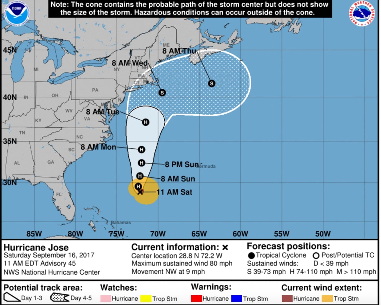
Storm watches are expected to be issued for the Northeast later Saturday covering late Tuesday through Wednesday.
While Jose tracks northward up the coast, its eye is expected to be at sea.
"We cannot rule out landfall in New England during the middle of next week," said AccuWeather Senior Meteorologist Dan Pydynowski.
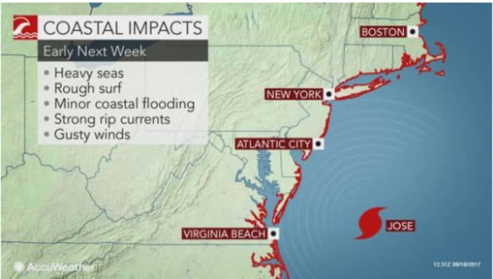
The exact track and strength of Jose will determine the severity of the wind and surf as well as the northwestern extent of the rain.
If Jose's eye stays far enough off the coast as new forecast paths project, its most significant effects will be to communities along and east of Interstate 95.
Should Jose be stronger than a Category 1 hurricane (its current status) and/or make landfall, more significant effects are likely.
"As Jose moves off the coast of the upper mid-Atlantic and New England, water temperatures drop significantly, which may lead to weakening or transformation to a sub-tropical system," according to AccuWeather Senior Meteorologist Brett Anderson.
There is still uncertainty surrounding Jose's strength and path. Check back to Daily Voice for updates.
Click here to follow Daily Voice West Orange and receive free news updates.